
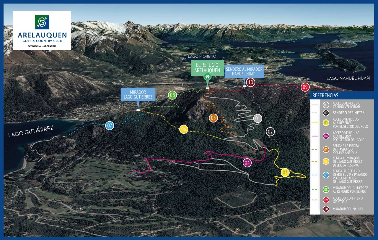
Trails and neighborhood map
Ten numbered routes: access roads, viewpoints and the paths to the Refugio Arelauquen.
The neighborhood has its own network of trails you can walk, bike or ride. Some are vehicle access roads (to the polo and golf areas); others are trekking paths leading to viewpoints and to the Refugio Arelauquen, with views over Lake Gutiérrez and Lake Nahuel Huapi.
Below is the official map with the 10 routes identified by color and number.
Recommendations: bring water and trekking shoes on the longer routes, leave early in summer to avoid midday heat, and let security know if you're heading to the Refugio.
The 10 trails
- 01Access to the Refugio (vehicle road)Color: White
- 02Perimeter trailColor: Gray
- 03Vehicle access to the reserve via the Polo areaColor: Yellow
- 04Vehicle access to the reserve via the Golf areaColor: Magenta
- 05Trail to Piedra de Hasburgo and Cueva AntiguaColor: Orange
- 06Trail to the Lake Gutiérrez viewpoint from the reserveColor: Light yellow
- 07Trail to the Refugio from the VIP, via the Lake Gutiérrez viewpointColor: Light blue
- 08Gutiérrez viewpoint to Refugio via the ridgeColor: Green
- 09Access to the rotating cafeteriaColor: Red
- 10Nahuel viewpointColor: Maroon
Looking for more detail, photos or member services?
Print or download the map